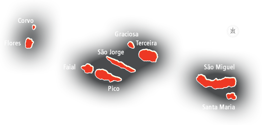
Azores archipelago |
|
| |
|
The Azores Autonomous Region has an area of 2324 sq. km.
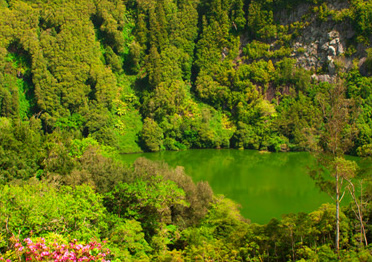
Despite the small size of the Azorean territory, the islands have a wide range of landscapes, forms and structures derived namely from the types of eruption, its dynamics and the subsequent actions of weathering. |
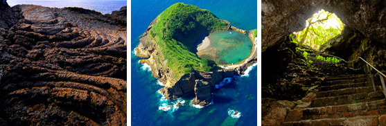 |
The evidence of this diversity is expressed in great morphologies and structures, such as calderas, lava fields, volcanic ridges, lakes, prismatic joints, etc..
The Azores geodiversity represents elements closely linked to the dynamics of planet Earth, in particular, the volcanism and geotectonic of this region. This geomorphological factor together with the insular dispersion, isolation and the Atlantic climate, create distinctive ecological conditions.
Thus, since the discovery and settlement of the Azores, in the
middle of the 15th century, the natural richness and the landscape were important sources of interest, that attracted numerous visitors and distinguished researchers. With the globalization and a greater and better access to information about the archipelago, in the last years there was an increased of the tourism in the Azores.
Fonte: LIMA, E.A., J.C. NUNES, M.P. COSTA e A. PORTEIRO, 2009. O geoturismo como instrumento de valorização do “Geoparque Açores”. In: C.N. CARVALHO, J. RODRIGUES & A. JACINTO (Ed.) – Geoturismo e Desenvolvimento Local. Câmara Municipal de Idanha-a-Nova / Geoparque NaturTejo, Lda., p. 149-160. |